Construction of the Wailua Beach portion of Ke Ala Hele Makalae starts
Construction of the path within the State's Kuhio Highway right-of-way along Wailua Beach began in early January, 2013. Following is a media release from the County of Kauai issued on December 7, 2012.
|
BERNARD P. CARVALHO, JR. |
DEPARTMENT OF PARKS & RECREATION |
GARY K. HEU |
Traffic will be periodically reduced to two lanes on Kuhio Highway fronting Wailua Beach
WAILUA – Before finalizing plans for the Wailua portion of Ke Ala Hele Makalae, the path that runs by the sea, the county engaged in many discussions with Native Hawaiian leaders, representatives of state and federal agencies, experts in coastal land use and cultural archaeology, as well as a broad cross-section of the community. A number of technical and cultural studies were also conducted.
“I want to acknowledge everyone that met with us over the years and expressed their feelings and concerns about the path alignment along Wailua Beach,” said Mayor Bernard Carvalho, Jr. “We took what was said and weighed it heavily into our decision-making as we have always considered the preservation and protection of the Hawaiian host culture of utmost importance.”
|
|
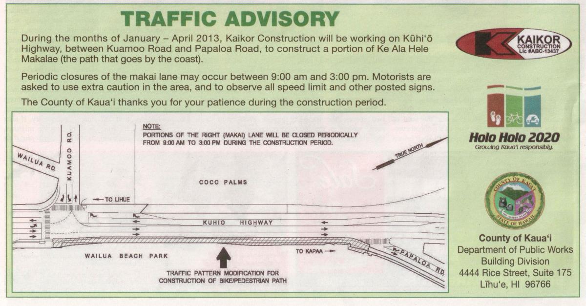
In January 2013, construction of the Wailua Beach portion of the path from Papaloa Road to Kuamo‘o Road is slated to begin. The project is expected to last a little over three months. Upon completion, it will connect to the Lydgate segment at the Kuhio Highway and Kuamo‘o Road intersection as well as the section along Papaloa Road. Traffic will be impacted by this large-scale project as K?hi‘? Highway along Wailua Beach will be periodically reduced from three lanes to two during construction. Motorists are encouraged to plan accordingly.
The construction schedule will be as follows, weather permitting:
-
Temporary restriping and installation of safety barriers on Kuhio Highway – Jan. 2 to Jan. 11.
-
Installation of the multi-use path – Jan. 11 to March 29.
-
Permanent restriping of Kuhio Highway – April 1 to 5.
|
A major change was made to the path’s original alignment after discussions with the various groups and the technical and cultural studies were completed. The result was a shift from the beach to the right-of-way along Kuhio Highway. Additionally, following the recent episodic erosion event, the design was modified so it can be removed if shoreline erosion threatens its stability in the future.
The plans now call for the path along Wailua Beach to be made in 10-ft. concrete sections that can be moved as needed.
In response to community concerns, the county went beyond the required Section 106 process of the National Historic Preservation Act, which is required for all federally funded projects. Cultural Surveys Hawai'i ("CSH") was contracted to do an archeological assessment and sub-surface investigation of the project area. The testing involved 17 backhoe-assisted trenches, which exposed large amounts of modern debris including: plastic bags and cups; aluminum cans; glass containers; and household and personal items. Asphalt and concrete bobbles and large basalt boulders were also uncovered in the trenches. No traditional Hawaiian or historic artifacts, cultural deposits, or cultural resources were found during the investigation.
|
|
|
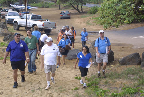
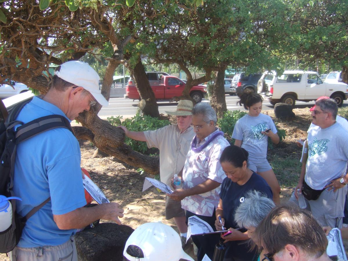
In 2008 (above) and 2010 (below) candidates for public office and Kauai Path volunteers walked the proposed Wailua Beach alignment. |
|
|
Additional work performed by CSH confirmed that there are no surface cultural resources, and the results of their ground penetrating radar survey were inconclusive. In its report, CSH said that the presence of modern debris suggests that any historic or prehistoric deposits that may have been in the project area have likely been removed, displaced or impacted during modern construction. Prior to the investigation conducted by CSH, the county held a number of community meetings to discuss the possible effects of the path on historic properties as required by Section 106. Input was provided by representatives from state and county agencies and local organizations including: Advisory Council on Historic Preservation; state Department of Land and Natural Resources; Friends of Kamalani and Lydgate Park; Halau Kanikapahuolohi‘au; Historic Hawai'i Foundation; Hui Malama I Na Kupuna o Hawai'i Nei; Kaua'i County Planning Department; Kaua'i Heritage Center; Kaua'i Historic Preservation Review Commission; Kaua'i Historic Society; Kaua'i-Ni'ihau Island Burial Council; Na Kahu Hikinaakala; and the Office of Hawaiian Affairs.
Ruby Pap, a coastal land agent with the University of Hawai'i ("UH") Sea Grant College Program, also provided comment on the path project. Pap said that according to coastal erosion studies done by the UH, Wailua Beach has experienced an overall pattern of shoreline accretion or growth over the past century at an average annual rate of 0.6 feet per year. However, she also pointed out that the historical shoreline positions visible on the erosion map indicate that shoreline position is highly variable at Wailua Beach, and the biggest erosion hazard is seasonal or episodic as opposed to a chronic long-term erosion trend.
The first segment of Ke Ala Hele Makalae was built nearly 10 years ago at Lydgate Beach Park. The Lihi to Ke?lia section was completed in 2008, and the Kealia to Kuna Bay segment was added in 2010. Currently, three smaller sections of the multi-use path are underway including: Lihi to Safeway; Papaloa Road; and an offshoot of the main path that extends one-half mile from Kuhio Highway up Kawaihau Road to Gore Park.
Phase four, which will run from Lydgate Park to Ahukini Landing, and Phase six, Nawiliwili to Ahukini Landing, are going through the environmental assessment ("EA") process. After the final EA is completed, the next step will be the special management area ("SMA") and Conservation District Use ("CDU") permitting process. Planning for Phase five, from Kuna Bay to Anahola, has resumed and a consultant has been contracted for the project.
During his inaugural speech titled Holo Holo 2020, Mayor Carvalho spoke about his vision for Kaua'i in the year 2020, which includes completing all planned segments of Ke Ala Hele Makalae. The multi-use path is one of 38 projects that are part of the mayor’s Holo Holo 2020 vision for Kaua'i, which calls for all organizations, businesses, residents and visitors on Kaua'i to be part of creating an island that is sustainable, values the native culture, has a thriving and healthy economy, cares for all – keiki to kupuna – and has a responsible and user-friendly local government.
###
Ke Ala Hele Makalae: The Path that Goes by the Coast from preventionspeaks on Vimeo.
- Login to post comments